
Is the North Sea rough? What to expect on the crossing
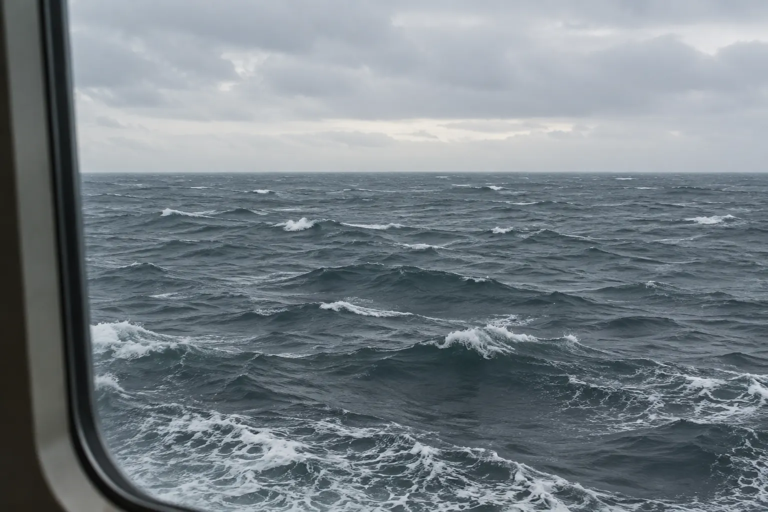
Often yes, but not in the way an ocean is rough. The North Sea is shallow, so it builds a short, steep, fast chop rather than long ocean swell, and it is rarely glassy even in settled weather. Winter crossings are commonly reported as uncomfortable; June to August sailings are usually much easier.
Crossing the North Sea this week? Dizzout is drug-free sound therapy you can start in your seat on the crossing, with relief in about 90 seconds.Starts in your browser · works with any headphones
Stop seasickness. Get your personalized Dizzout plan. Paid subscription for full access.

On your phone? Scan to start there.
Sea · North-west Europe · Reputation among passengers: has a long-standing reputation for rough passages.
- Low
- Moderate
- High
- Very high
Roughness summarises typical reported conditions for this crossing, not a forecast for any given sailing.
Shallow basin, short steep wind chop
In the Nausea Index table of the 121 sea crossings we cover, the North Sea is rated rough, one of 34 in that band, with 6 rated higher. Full table: the roughest sea crossings, ranked.
Key facts
- The North Sea is a sea, and passenger reports place it in the high roughness band.
- The mechanism behind that reputation: Shallow basin, short steep wind chop.
- Conditions are reported roughest in January, February and December.
- The calmest months are usually June, July and August.
- It is also known as Noordzee / Nordsee.
Why is the North Sea so rough?
Depth. The North Sea averages roughly 90 m and the southern half is much shallower still, with large areas under 50 m and around 15 to 30 m over the Dogger Bank. Shallow water cannot support long swell, so wind energy goes into short, steep waves that build within hours and stay close together. That short spacing is the problem: the vertical motion it produces sits inside the frequency band people are most easily made sick by, roughly one cycle every two to ten seconds.
When is the North Sea roughest?
December to February is the roughest stretch, with the seasonal peak in wave height falling around mid-January in the south and late January or early February further north. October and November are already firmly in the storm season. Things ease through April and May. June, July and August are the reliable window, with typical wave heights roughly half their winter values, before gales return from late September.
| Roughest water in Jan | Roughest water in Feb | Roughest water in Mar | Roughest water in Apr | Roughest water in May | Roughest water in Jun | Roughest water in Jul | Roughest water in Aug | Roughest water in Sep | Roughest water in Oct | Roughest water in Nov | Roughest water in Dec |
|---|---|---|---|---|---|---|---|---|---|---|---|
| Roughest | Roughest | Rough | Mixed | Mixed | Calm | Calm | Calm | Mixed | Rough | Rough | Roughest |
Typical seasonal pattern, not a forecast. Any month can deliver a calm crossing or a bad one. Check the marine forecast for your sailing date. Select a month to see every sea and ferry crossing ranked for it.
Where to be on board
Front to back
- Bow (front)Avoid
- MidshipBest
- Stern (aft)OK
The crossing: 6h30-17 hours
Roughest stretch: The open middle, well clear of both coasts
Go low and central. On short-period chop, upper decks pitch and jolt noticeably more than the waterline.
Get your read
A few quick questions about you, then your trip. Nothing is saved or sent.
Step 1: about you
How you usually react to travel is the single best signal. These come from the validated MSSQ.
Step 2: your trip
Pick the kind of trip you are planning.
Keep your crossing kit close
Sort out your crossing plans first. You can prepare Dizzout and ordinary headphones once you are seated indoors.
Free to download. Paid subscription for full access.
30,000+ travelers in 30+ countries · How we count

On your phone? Scan to start there.
Comparing apps first? See how the motion sickness apps compare
Not travelling yet? Remind me the day before my trip

Know someone who gets motion sick?
Send them the app that helps stop it, drug-free, in about 90 seconds, works with any headphones. Free to download.
The crossings that cross it
| Route | Typical duration | What to know |
|---|---|---|
| Newcastle to Amsterdam | about 16 to 17 hours | Overnight, across the open middle of the sea. |
| Harwich to Hook of Holland | about 6h30 to 8 hours | Southern North Sea, over the shallowest water on this list. |
| Hull to Rotterdam | about 11 to 12 hours | Overnight sailing across the southern North Sea. |
| Aberdeen to Lerwick | about 12 to 15 hours | NorthLink's overnight run to Shetland, the longest domestic ferry route in the UK. |
| Hirtshals to Torshavn | about 30 to 38 hours | Smyril Line's Norrona to the Faroes; leaves the North Sea for the open Atlantic. |
What helps on this crossing
- Overnight sailings help here: the worst of the motion often passes while you are lying flat in a bunk rather than sitting upright.
- Short-period chop rattles rather than rolls. Bracing your feet and keeping your head against a fixed headrest cuts the jolting.
- The southern crossings sit over the shallowest water, so they build a sharper sea faster than the deeper northern routes.
- Watch the wind direction, not just the wind speed. A northerly has the whole length of the sea to work with; a westerly has far less.
- Check the shipping forecast for sea areas Humber, Thames, Dogger and German Bight before you travel.
- In June to August the same route is a different experience: wave heights are typically around half what they are in January.
Buying a tablet in the UK before you sail? UK pharmacies sell Kwells, Stugeron and Avomine for travel sickness, and their labels differ on when to take them. Kwells vs Stugeron and Stugeron vs Avomine set out the label facts side by side. Which one suits you is a question for the pharmacist.
For the full toolkit see the seasickness guide, or what to do once it has already started. For what the trials actually say about the oldest trick on that list, see the verdict on looking at the horizon. If the rocking follows you ashore afterwards, that is land sickness, which is normal, and it passes.
Frequently asked questions
Is the North Sea rough in June?
June is one of the calmer months. Typical significant wave heights in the North Sea drop to roughly 1 to 1.5 m in summer against 2 to 3 m in winter, and gales are much less frequent. That does not mean flat, because the sea is shallow enough to raise a chop quickly if the wind gets up, but June crossings are commonly reported as comfortable.
Is the North Sea rough in January?
January is the roughest month on most of the North Sea. The seasonal peak in wave height falls around the middle of the month in the southern part and towards the end of it further north, and Atlantic depressions cross the UK in sequence. Ferries still sail, but heavy motion and occasional delays are normal at this time of year.
Why is the North Sea so choppy rather than swelly?
Because it is shallow. Long swell needs deep water to travel through; the North Sea averages about 90 m and much of the south is under 50 m, with the Dogger Bank shallower again, at roughly 15 to 30 m. Wind energy therefore goes into short, closely spaced waves that build fast and die back fast. The ride feels like jolting and slamming rather than a slow ocean roll.
Which month is the calmest for a North Sea ferry crossing?
June, July and August, with July usually the steadiest of the three. Summer wave heights run at roughly half their winter values and gale frequency is at its annual low. May and early September are reasonable second choices. From late September onward the autumn storm pattern sets in and conditions become much less predictable.
Does the North Sea get rough in October?
Often. October is the start of the North Sea storm season, and the change from September can be abrupt. Wave heights climb back towards winter values and named windstorms begin appearing across north-west Europe. Early October is frequently still pleasant; the second half of the month is where autumn conditions usually take hold.
Other crossings
Sources & further reading
- https://marine.gov.scot/sma/assessment/wave-climate
- https://www.bsh.de/EN/DATA/Climate-and-Sea/Sea_state/Sea_state_statistics/sea_state_statistics_node.html
- https://www.dfds.com/en/passenger-ferries/ferry-crossings/ferries-to-holland/newcastle-amsterdam
- https://nora.nerc.ac.uk/id/eprint/10533/1/WavesNORA.pdf
Sea conditions described here are typical patterns drawn from published marine and operator information as of July 2026, not a forecast: conditions on any given sailing depend on the weather that day, and any month can deliver a calm crossing or a bad one. Route and operator names are trademarks of their respective owners; Dizzout is not affiliated with or endorsed by them. Seasickness sensitivity varies from person to person; this page is informational and not medical advice.